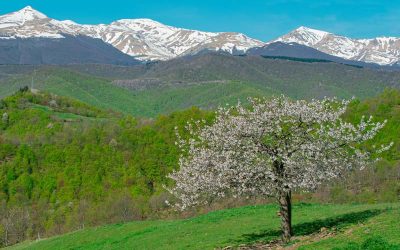
From Ceppo to Pizzo di Moscio
Starting from the Ceppo square, take the uphill road following the signs for the campsite. Once you arrive at the campsite, walk along the dirt road that climbs to the left.
After a few kilometers uphill you will arrive at Lago dell’Orso (1800 masl), here it is possible to admire the whole chain of the Monti della Laga and, in particular, on the left you can see the summit of Monte Gorzano.
At this point, continue on the panoramic ridge that climbs up to La Storna and, steeply, to the summit of Pizzo di Moscio (2411 masl); this is the most difficult part of the route but once you get to the top the wonderful and wide views of the Laga, the Gran Sasso, the Twin Mountains and the Sibillini Mountains will open up, a breathtaking view that will make you forget the effort just made.
In the past, the Pizzo di Moscio path had particular names that have always characterized it. Among these we can mention:
-
- Hannibal’s path;
- the path of the brigands operating between the papal state and the kingdom of the two Sicilies;
- the path that crosses the Monti Della Laga, along the route of the ancient Roman road metella;
- The path followed by the shepherds of the towns of the Laga, hired by the great Amatrician herding families;
- the path that evokes the ancient relationships between the populations of the eastern and western slopes of Monti Della Laga, which ceased with the construction of the rolling roads, only minimally substituting for the historical pedestrian ones.
Difficulty: Hiking
Maximum altitude: 2411 m.
Length: 7800 m.
Duration: 06:30:00
Altitude:
Ascent with difference in altitude 1036 m.
Descent with difference in altitude 1036 m.
Download the IGM map (source: Province of Teramo)
For an excursion in complete safety it is recommended to use suitable equipment and tools and always have the utmost attention.

Ceppo
Pizzo di Moscio
Blog of the Wood
Hannibal and the Monti della Laga
The territory of Rocca Santa Maria is located in a geographical position of hinge between central and southern Italy,...
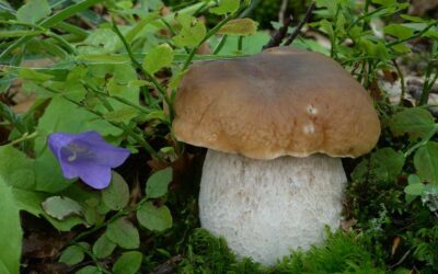
Il Ceppo: the ideal place for the kingdom of mushrooms
The Strain, due to the particular morphology of its territory, and its climatic characteristics, is the ideal place...
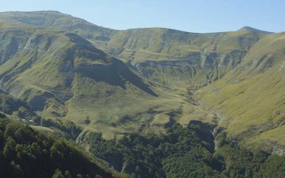
Discovering the Gran Sasso and Monti della Laga National Park
The Gran Sasso and Monti della Laga National Park is a place of extraordinary beauty, rich in animal and plant species...