The territory of Rocca Santa Maria is located in a geographical position of hinge between central and southern Italy, where, in past centuries, there was the border between the Papal State and the Kingdom of Naples.
Exactly in these places passed the ancient Roman road that took its name from the Roman consul who created it: the via Metella. This historical-mythological route connected the Adriatic coast to the Via Salaria passing through the Monti della Laga.
The presence of this Roman road came to light in 1823 when, in the locality of Vallorino di Sant’Omero, a Roman milestone was found that reported the exact distance from Rome coinciding with the route of the itinerary traced by this road.
It is precisely from here that Hannibal’s Carthaginian army, made up of men and elephants, also passed to surprise the Romans on the Adriatic coast.
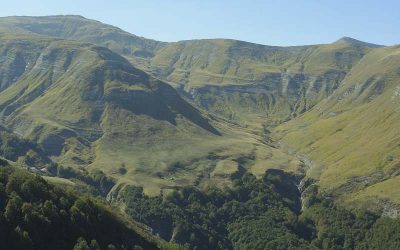
As evidence of the passage of Hannibal between the Monti della Laga, and of the clashes that took place right in this territory between the Carthaginians and the Romans, toponyms remain such as “Valico di Annibale” (between the peaks of Monte Gorzano at 2458 meters above sea level), the “Tracciolino di Annibale” (Pizzo di Sebo at 2422 meters above sea level), the “Valley of hell” , the “Mount of the Dead” and the “Macera della Morte” (here there would have been a bloody battle between the Romans and the Carthaginians and it is said that the numerous bodies of the fallen would have been stacked in pyres and left to “macerate”.)